一款非常实用的gps制图软件,有了这款软件,我们就可以将购买或扫描的Web地图或数字地图在计算机屏幕上进行工作,可配合Garmin 或 Magellan 等GPS设备进行使用,让你可以在航海、环山越野、徒步旅行、攀岩、野餐、郊游、海钓时找到自己的方位,并制定出最佳行进路线
OkMap is an interactive software which allows you to work on your computer screen with web maps or digital maps that you have either bought or scanned. OkMap can also import vectorial data from the most common formats and DEM data relevant to height information. Through these maps, you can organize your paths by creating waypoints, routes and tracks on your computer monitor, and upload this data to your GPS. OkMap sets automatically altitude data and estimates travel times.
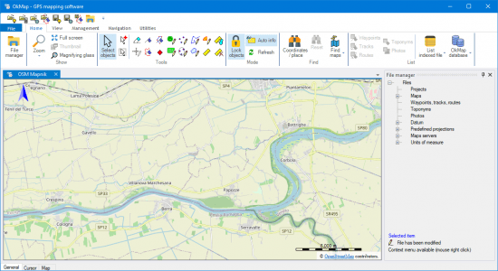
Features:
Calibration / display raster maps (over 30 image formats)
Display vectorial maps
Display hybrid maps (raster + vectorial data)
Ability to open multiple maps simultaneously
9 cartographic projections of the most used
Database with over 500 predefined projections by geographic area
Database with over 300 datum
Viewing 3D raster maps on Google Earth (for supported image formats)
Map add-ons management (icons, comments)
Vectorial data management (point, multipoint, line, polygon)
GPX data management (waypoints, tracks, routes)
Selecting multiple objects with the mouse
Context menu (right mouse)
Auto-info function
Zoom, autofit functions
Moving map function in 3 modes
Customizing toolbar
Showing yes / no toolbar
Showing yes / no statusbar
Check new releases at startup
Homepage
http://www.okmap.org
文件大小:378.38MB
百度网盘下载:
本站解压密码:caxfwz


请先 !